Bright foliage just east of Salina.
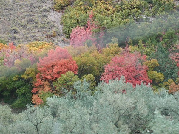
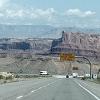
The band of smoke was from a truck ahead of us.

NEXT  
Look carefully, and you'll see me way out near the end of this snaking bluff. - What you see where I am is a dark vertical line. Now I'm on the very top of the bluff. - Look for a dark spot amidst the tall grasses. Running back to Larry and the car. Saturday, October 2: -  - This morning we drove out Route 128 along the Colorado River east of Moab and hiked up the Negro Bill Canyon Trail along a babbling creek, that we had to cross a few times, as we went up the canyon.  (Chuck said the canyon used to be called N-something-else Bill Canyon Trail, but was changed to be more politically correct.  Now, Chuck said, some folks are talking about changing it again to Brother Bill Canyon Trail, which seemed dumb to me since 'brother' is another racial term that will likely someday fall out of favor as all eventually do.  Why not just 'Bill's Canyon?' I said.) -  - We had a pleasant hike and never got wet crossing the creek.  We saw lots of other people, many with their dogs, because it was a great place for a dog -- lots of places to wade, and slurp up water if it's dry and hot.  We had to watch out for poison ivy along the trail in places.  The canyon dead-ended, and right there was a huge arch over it.  Some people were walking on the arch, and they later rapelled down the face of the canyon next to the arch while we were sitting there eating our lunch.

[ Trip to Utah in Fall 2004 ]
(Return to beginning of this slide show.)

[ Bill & Larry's Adventures - The West Archive ]
(Leave this slide show and go to "The West" archived entries.)

[ Bill & Larry's Adventures ]
(Leave this slide show and go to our most recent entries.)

[ Bill & Larry's Home Page ]